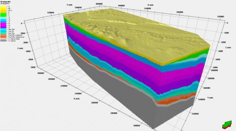
The geological model of Gorzów block shows the upper 5 000 m of the sedimentary stack of the block: from the roof of the Carboniferous up to the Quaternary. The model is based on most of the geological data collected so far in the area: 23 seismic volumes covering a total of 5500 square km, over a thousand 2D seismic lines, and wireline logs from 300 deep boreholes. Existing geological maps and gravimetric data were used in addition. Legacy and current data and analyses – focused so far almost exclusively on Permian oil and gas deposits exploited in the area – was thus consolidated and greatly extended by detailed analysis of the Mesozoic and Cenozoic.